Coffee Pot Fire 2024
Coffee Pot Fire is the 4th-largest wildfire this season in California, burning 8 miles southeast of Three Rivers.
Latest update
Daily Update | Daily Operations Videos | Daily Public Information Map | Daily Fire Progression Map | Evacuation Map | Smoke Outlook / Air Quality Report
Camera views of area/smoke impacts: NPS.gov – Air Webcams | Windy.com | ALERT California
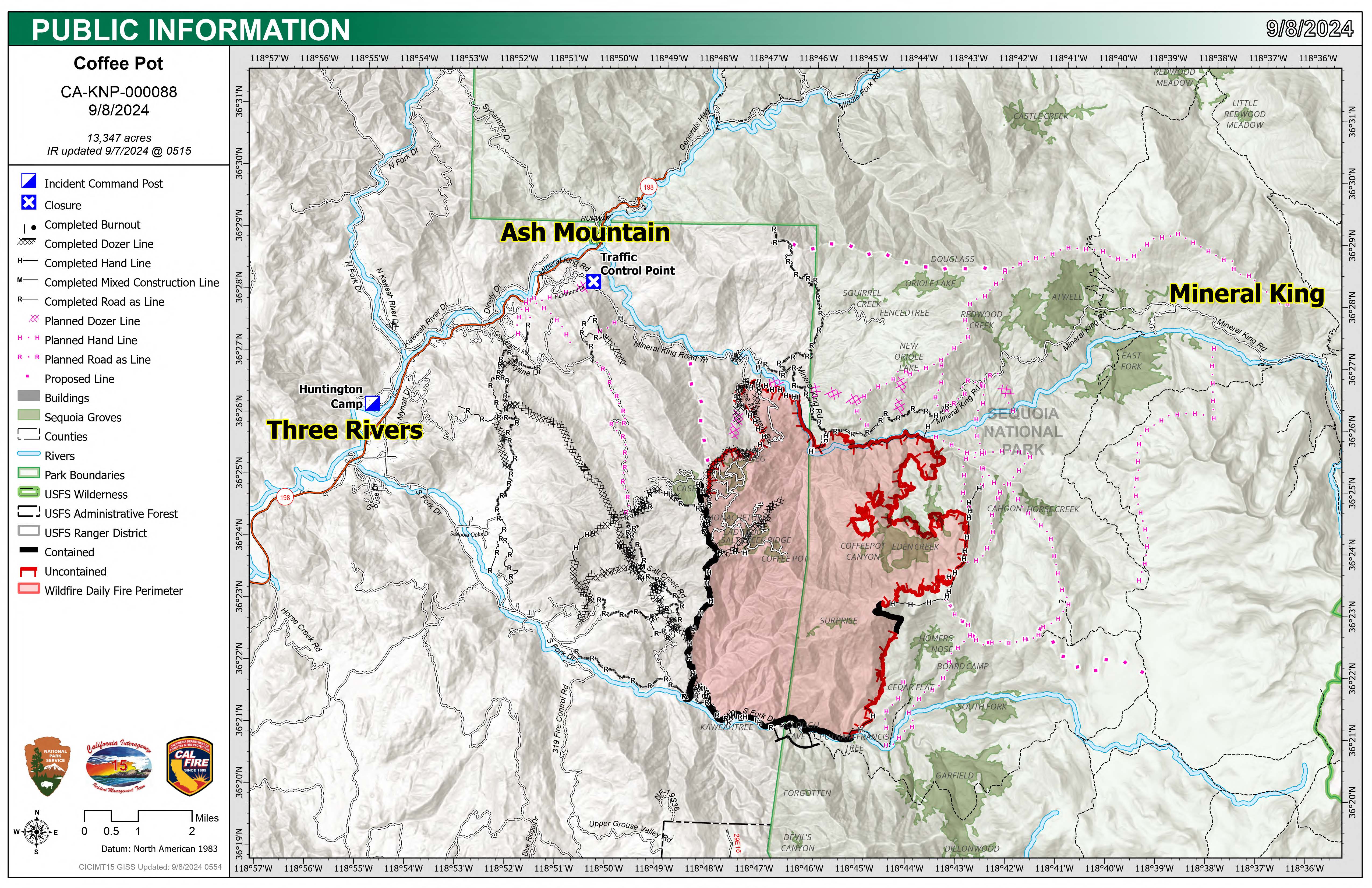
Unified Command: SACIMT2
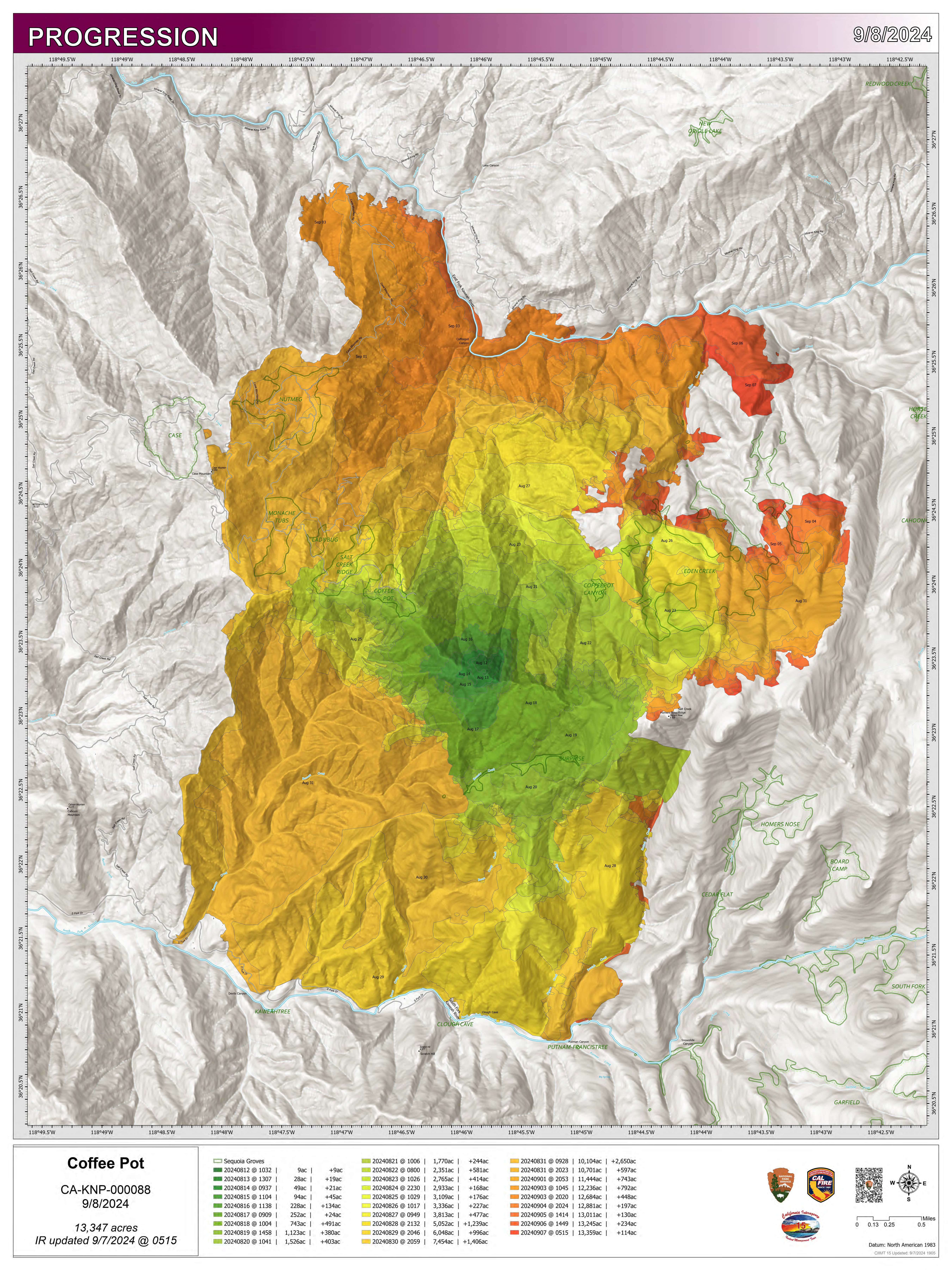
Fire Size: 14,104 acres
Percent Contained: 100%
Primary Strategic Control Line:
Personnel: 40
Cause: Lightning
Start Date: Saturday, August 3, 2024, at 10:05 a.m.
Location: Southeast of Three Rivers, CA
This is the final daily update for the Coffee Pot Fire. The Sequoia and Kings Canyon National Parks will release information if fire conditions change.
CURRENT SITUATION: As of Oct. 29, 2024, the Coffee Pot Fire remains at 14,104 acres and is 93% contained. The Coffee Pot Fire has transitioned to a Type 5 Incident Management Team from the Sequoia National Park Fire Management Office. Ground and aerial patrols continue to monitor the fire for any visual or infrared changes, or threats to containment lines. There have been no heat signatures near or close to the fire containment lines since Sept. 26, 2024. Heat signatures and visible smoke remain present within the fire footprint as interior areas continue to smolder and burn, however, there are no threats to containment lines currently.
WEATHER: Mostly sunny, slight chance of rain and snow. Max temperature 47-57, except 32-42 above 6000 feet. Min humidity 59-69 percent.
SMOKE IMPACTS: For more information on current wildfire smoke impacts in your community, please visit AirNow.gov or fire.airnow.gov.
EVACUATION NOTICES: To find your zone, please refer to: protect.genasys.com.
FIRE INFORMATION: For Coffee Creek Fire information, please visit Caknp Coffee Pot Fire Information | InciWeb (wildfire.gov).
BLM AND PARK CLOSURES: The Ladybug trail, accessed from the South Fork Drive, within Sequoia National Park boundaries remains closed. Park closure information is available online at nps.gov/seki.
PUBLIC NOTICE: Wildfires are a no-fly zone for unauthorized aircraft, including drones. If you fly, we can’t. For more information, visit knowbeforeyoufly.org.