Rosa Fire 2025
Rosa Fire has burned 1,671 acres, burning 30 miles southeast of Banning.
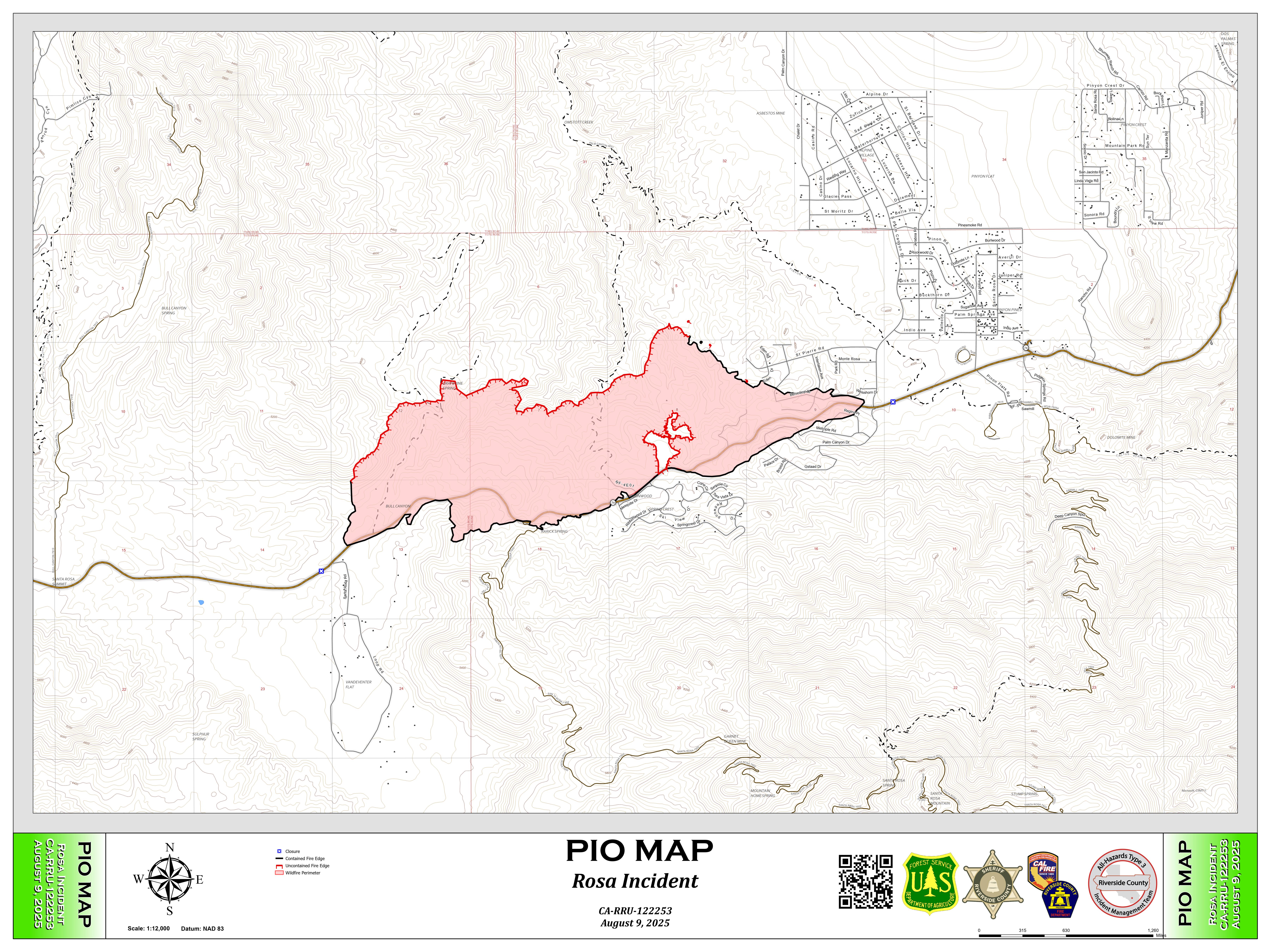
Latest update
Rosa Fire Last Update Final Rosa Fire Map
The fire remains within the existing perimeter, no growth is expected. Fire Suppression repair has been completed.
Management of the fire has been turned back to the local units (Riverside County Fire, and the San Bernardino National Forest.
Closures:
Pinyon Campground, Santa Rosa Truck Trail and associated remote "yellow post" campsites, Cahuilla Tewanet Viewpoint, and the Sawmill and Cactus Springs Trail have reopened for public use.
The Upper Palm Canyon Trail will remain closed and a long-term closure order will be issued which will assist the fire area to begin the recovery process.
Information for Residents:
Sign up for local emergency alerts at: RivCoReady.org/AlertRivCo and download the Genasys Protect app
Protect your property: Learn about Defensible Space at https://www.fire.ca.gov/dspace
For additional information when returning home after a wildfire, refer to: www.readyforwildfire.org
Incident Camera Link: https://cameras.alertcalifornia.org/?pos=33.7403_-116.4633_9&id=Axis-ToroPeak1
Air Quality: For Up-to-date information on air quality in your area, please visit https://fire.airnow.gov/ For links to information and tips on managing wildfire smoke exposure, please visit: https://californiasmokeinfo.blogspot.com/
Evacuation Orders:
All residential evacuation orders arehave been rescinded.
Power Pole Replacement continues in the Fire effected area. click https://www.anzaelectric.org/rosa-fire to read a message about ongoing efforts to re-energize the area.